
TABLE MOUNTAIN: BLINK WATER NEEDLE
.
April 2021
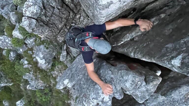
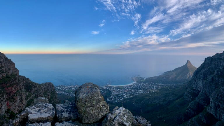
Blinkwater Needle is a tough hike which involves a lot of elevation gain in a relatively short distance. The path up can be tricky to find, and also becomes quite faint at times with loose soil, overgrown vegetation, and exposed drop-offs being a common theme. It is best suited to those with a decent fitness level. Getting to the top of the needle requires some scrambling (rock climbing but without ropes), which isn’t too difficult if you know what you are doing, are sure footed, and comfortable with heights. Sitting on top of the needle is cramped, so you will need to be conscious of your surroundings and the wind.
There are 2 parking options, the longer option which adds ±7km in total to your hike is to park at Kloof Nek, and follow the Pipe Track trail until you see a sign for Diagonal. The other option is to park at Teresa Avenue, however parking bays are limited due to the fact that it is a residential area. Please be considerate and keep as quiet as possible, and dont park in driveways/block driveways/block the street, we want to be able to continue to use this location. If we anger the residents the use of this area may no longer be viable.
From the Teresa Ave parking follow the cement road up the mountain, and after a few hundred meters take the fork to the left. The road continues up and when it begins to level out look for a faint path leading off to the right. Follow it up the Pipe Track and turn left and make your way in the direction of Lions Head. You will soon come to a sign for Diagonal, which is the path you will take.
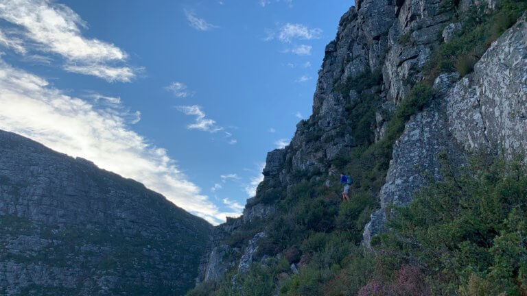
The trail weaves its way back and forth up the mountain, and eventually you will come to bend in the path. This is where navigation and following the right path becomes tricky. The path you need to follow branches off to the left, through the overgrown bushes, and doesn’t really look like its going anywhere. You need to follow it for a good 30 or more meters before the trail becomes more visible. It is not like the path you just been hiking on, and this trail is called Blind Gully.
Be on the look out for cairns (man made piles of rock which act as route markers) to point you in the right direction. The trail gets quite steep, slippery and dangerous so focus on the trail and take it easy. You are in for about a 60 minute intense cardio session depending on your fitness level. It can be completed faster than that by the fit peeps out there, but take your time and be safe. Eventually you will make it to the base of Blinkwater Needle, which will be evident by the pile of rock pointing up into the sky. Continue around the back and climb up the rocks. Its a little tricky to find the safest chimney to scale up, so we advise using a guide to point you in the right direction. Once on the top enjoy the views and your snacks before making your way back down to the path.
We suggest you continue going up the mountain and descend via the Diagonal and Porcupine paths rather than going down the way you came up. As you will have seen the path is very steep and treacherous, so going down will be really tough especially if it is wet. Once off of the needle, follow the path that leads up the mountain and make sure you take the trail fork which bends around and up to the right. Be on the look out for cairns as the route does become a little overgrown, and difficult to find in places. You will also need to scale up a a few sections of rock to stay on the right path, but nothing like what you have just done. Once at the top of the mountain navigation again becomes a little sketchy, just keep going straight head until you intersect with the main path running on top the mountain. Here you can either turn left and head towards the cable car, or turn right and make your way down via Diagonal and Porcupine Ravine.
Following the path you will eventually get to a old fence which splits the path in 2 directions. take the path down and to the left. Keep going until you see a sign post pointing to Kasteelspoort and the Cable Car. Turn right here, even though the sign doesn’t say what path you taking. Follow the trail, which heads down the mountain and be on the look out for a path feeding off to the right, this will take you to Porcupine Ravine which you will follow until you come across a left turn. This is where you intersect the original path that you took up the mountain earlier. Follow the path and you will end up back at Pipe track.
This is a tricky and adventurous hike, and best to enlist the services of a guide or someone who knows where they are going. It is quite easy to get lost and take the wrong turn and end up on the wrong path. Coming down the mountain is difficult, and involves loose rock and shale, so please exercise caution and take it slowly.
Please note that this is our interpretation of the hike and is not meant to be used for navigation purposes. Hiking can involve dangerous elements, and remember that the weather on top of a mountain is always different to that at the base. Remain aware of your surroundings at all times, wear the appropriate clothing and footwear, don’t litter and stick to the foot paths. Do not light a fire no matter what.
NEED TO KNOW:
- DURATION: 3 – 6 hours depending on your fitness levels.
- DISTANCE: ±9 km from Teresa Ave
- EFFORT LEVEL: 9/10
- TECHNICAL DIFFICULTY: 8/10
- REQUIREMENTS: Comfortable shoes with adequate grip, water bottle, snacks, warm top.
- ENTRY FEE: No entry fee. Cable car ticket down is R200.
- AMENITIES: Nothing near by, have to make your way to the cable station
- SAFETY: 8/10 Always monitor your surroundings.
- ACCESSIBILITY: You will need to be fit and mobile to complete this hike. Not advisable for small kids.
- ROUTE MARKINGS: 3/10
- SCENERY: 10/10
Click HERE to design your day of fun and adventure!
TABLE MOUNTAIN:
BLINKWATER NEEDLE

April 2021
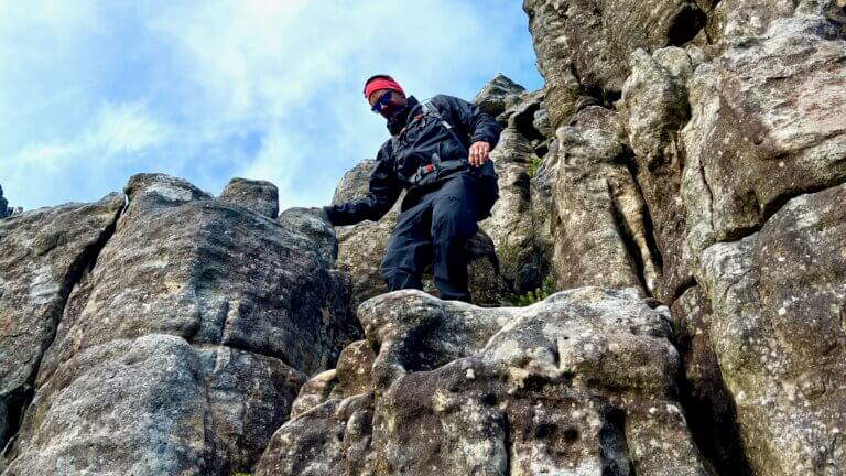
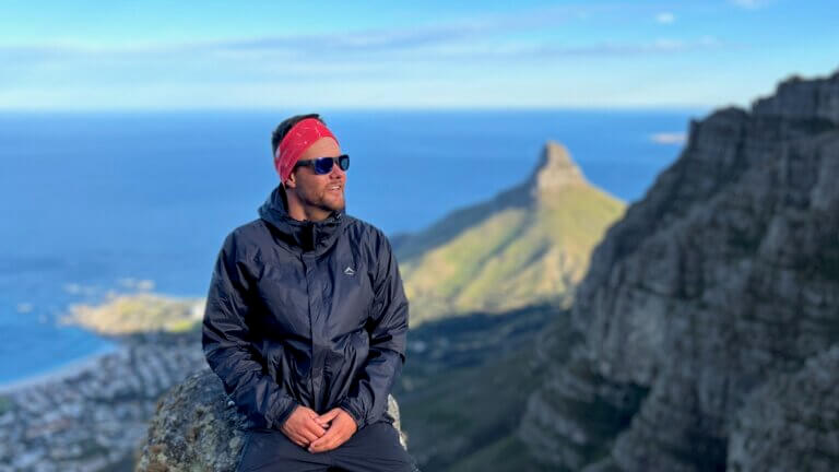
Blinkwater Needle is a tough hike which involves a lot of elevation gain in a relatively short distance. The path up can be tricky to find, and also becomes quite faint at times with loose soil, overgrown vegetation, and exposed drop-offs being a common theme. It is best suited to those with a decent fitness level. Getting to the top of the needle requires some scrambling (rock climbing but without ropes), which isn’t too difficult if you know what you are doing, are sure footed, and comfortable with heights. Sitting on top of the needle is cramped, so you will need to be conscious of your surroundings and the wind.
There are 2 parking options, the longer option which adds ±7km in total to your hike is to park at Kloof Nek, and follow the Pipe Track trail until you see a sign for Diagonal. The other option is to park at Teresa Avenue, however parking bays are limited due to the fact that it is a residential area. Please be considerate and keep as quiet as possible, and dont park in driveways/block driveways/block the street, we want to be able to continue to use this location. If we anger the residents the use of this area may no longer be viable.
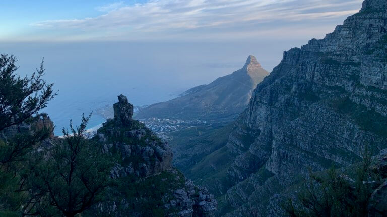
From the Teresa Ave parking follow the cement road up the mountain, and after a few hundred meters take the fork to the left. The road continues up and when it begins to level out look for a faint path leading off to the right. Follow it up the Pipe Track and turn left and make your way in the direction of Lions Head. You will soon come to a sign for Diagonal, which is the path you will take.
The trail weaves its way back and forth up the mountain, and eventually you will come to bend in the path. This is where navigation and following the right path becomes tricky. The path you need to follow branches off to the left, through the overgrown bushes, and doesn’t really look like its going anywhere. You need to follow it for a good 30 or more meters before the trail becomes more visible. It is not like the path you just been hiking on, and this trail is called Blind Gully.
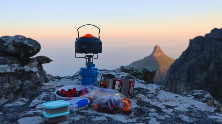
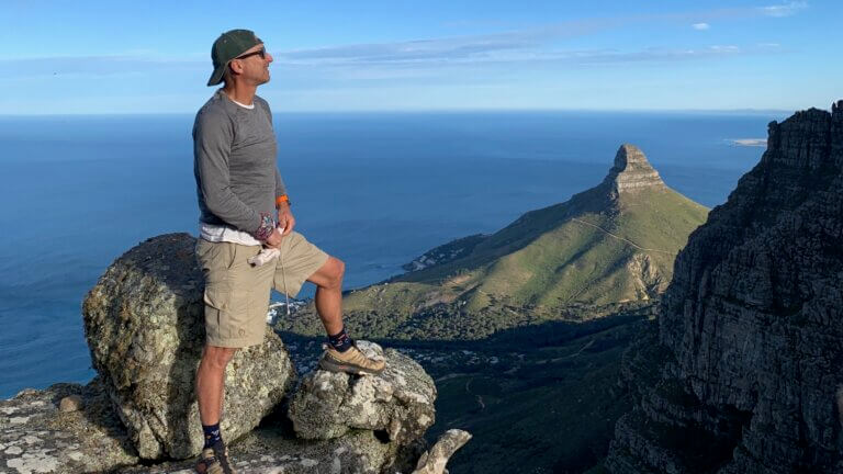
Be on the look out for cairns (man made piles of rock which act as route markers) to point you in the right direction. The trail gets quite steep, slippery and dangerous so focus on the trail and take it easy. You are in for about a 60 minute intense cardio session depending on your fitness level. It can be completed faster than that by the fit peeps out there, but take your time and be safe. Eventually you will make it to the base of Blinkwater Needle, which will be evident by the pile of rock pointing up into the sky. Continue around the back and climb up the rocks. Its a little tricky to find the safest chimney to scale up, so we advise using a guide to point you in the right direction. Once on the top enjoy the views and your snacks before making your way back down to the path.
We suggest you continue going up the mountain and descend via the Diagonal and Porcupine paths rather than going down the way you came up. As you will have seen the path is very steep and treacherous, so going down will be really tough especially if it is wet. Once off of the needle, follow the path that leads up the mountain and make sure you take the trail fork which bends around and up to the right. Be on the look out for cairns as the route does become a little overgrown, and difficult to find in places. You will also need to scale up a a few sections of rock to stay on the right path, but nothing like what you have just done. Once at the top of the mountain navigation again becomes a little sketchy, just keep going straight head until you intersect with the main path running on top the mountain. Here you can either turn left and head towards the cable car, or turn right and make your way down via Diagonal and Porcupine Ravine.
Following the path you will eventually get to a old fence which splits the path in 2 directions. take the path down and to the left. Keep going until you see a sign post pointing to Kasteelspoort and the Cable Car. Turn right here, even though the sign doesn’t say what path you taking. Follow the trail, which heads down the mountain and be on the look out for a path feeding off to the right, this will take you to Porcupine Ravine which you will follow until you come across a left turn. This is where you intersect the original path that you took up the mountain earlier. Follow the path and you will end up back at Pipe track.
This is a tricky and adventurous hike, and best to enlist the services of a guide or someone who knows where they are going. It is quite easy to get lost and take the wrong turn and end up on the wrong path. Coming down the mountain is difficult, and involves loose rock and shale, so please exercise caution and take it slowly.
NEED TO KNOW:
- DURATION: 3 – 6 hours depending on your fitness levels.
- DISTANCE: ±9 km from Teresa Ave
- EFFORT LEVEL: 9/10
- TECHNICAL DIFFICULTY: 8/10
- REQUIREMENTS: Comfortable shoes with adequate grip, water bottle, snacks, warm top.
- ENTRY FEE: No entry fee. Cable car ticket down is R200.
- AMENITIES: Nothing near by, have to make your way to the cable station
- SAFETY: 8/10 Always monitor your surroundings.
- ACCESSIBILITY: You will need to be fit and mobile to complete this hike. Not advisable for small kids.
- ROUTE MARKINGS: 3/10
- SCENERY: 10/10
Please note that this is our interpretation of the hike and is not meant to be used for navigation purposes. Hiking can involve dangerous elements, and remember that the weather on top of a mountain is always different to that at the base. Remain aware of your surroundings at all times, wear the appropriate clothing and footwear, don’t litter and stick to the foot paths. Do not light a fire no matter what.
TABLE MOUNTAIN:
BLINKWATER NEEDLE
April 2021
Blinkwater Needle is a tough hike which involves a lot of elevation gain in a relatively short distance. The path up can be tricky to find, and also becomes quite faint at times with loose soil, overgrown vegetation, and exposed drop-offs being a common theme. It is best suited to those with a decent fitness level. Getting to the top of the needle requires some scrambling (rock climbing but without ropes), which isn’t too difficult if you know what you are doing, are sure footed, and comfortable with heights. Sitting on top of the needle is cramped, so you will need to be conscious of your surroundings and the wind.
There are 2 parking options, the longer option which adds ±7km in total to your hike is to park at Kloof Nek, and follow the Pipe Track trail until you see a sign for Diagonal. The other option is to park at Teresa Avenue, however parking bays are limited due to the fact that it is a residential area. Please be considerate and keep as quiet as possible, and dont park in driveways/block driveways/block the street, we want to be able to continue to use this location. If we anger the residents the use of this area may no longer be viable.
From the Teresa Ave parking follow the cement road up the mountain, and after a few hundred meters take the fork to the left. The road continues up and when it begins to level out look for a faint path leading off to the right. Follow it up the Pipe Track and turn left and make your way in the direction of Lions Head. You will soon come to a sign for Diagonal, which is the path you will take.
The trail weaves its way back and forth up the mountain, and eventually you will come to bend in the path. This is where navigation and following the right path becomes tricky. The path you need to follow branches off to the left, through the overgrown bushes, and doesn’t really look like its going anywhere. You need to follow it for a good 30 or more meters before the trail becomes more visible. It is not like the path you just been hiking on, and this trail is called Blind Gully.
Be on the look out for cairns (man made piles of rock which act as route markers) to point you in the right direction. The trail gets quite steep, slippery and dangerous so focus on the trail and take it easy. You are in for about a 60 minute intense cardio session depending on your fitness level. It can be completed faster than that by the fit peeps out there, but take your time and be safe. Eventually you will make it to the base of Blinkwater Needle, which will be evident by the pile of rock pointing up into the sky. Continue around the back and climb up the rocks. Its a little tricky to find the safest chimney to scale up, so we advise using a guide to point you in the right direction. Once on the top enjoy the views and your snacks before making your way back down to the path.
We suggest you continue going up the mountain and descend via the Diagonal and Porcupine paths rather than going down the way you came up. As you will have seen the path is very steep and treacherous, so going down will be really tough especially if it is wet. Once off of the needle, follow the path that leads up the mountain and make sure you take the trail fork which bends around and up to the right. Be on the look out for cairns as the route does become a little overgrown, and difficult to find in places. You will also need to scale up a a few sections of rock to stay on the right path, but nothing like what you have just done. Once at the top of the mountain navigation again becomes a little sketchy, just keep going straight head until you intersect with the main path running on top the mountain. Here you can either turn left and head towards the cable car, or turn right and make your way down via Diagonal and Porcupine Ravine.
Following the path you will eventually get to a old fence which splits the path in 2 directions. take the path down and to the left. Keep going until you see a sign post pointing to Kasteelspoort and the Cable Car. Turn right here, even though the sign doesn’t say what path you taking. Follow the trail, which heads down the mountain and be on the look out for a path feeding off to the right, this will take you to Porcupine Ravine which you will follow until you come across a left turn. This is where you intersect the original path that you took up the mountain earlier. Follow the path and you will end up back at Pipe track.
This is a tricky and adventurous hike, and best to enlist the services of a guide or someone who knows where they are going. It is quite easy to get lost and take the wrong turn and end up on the wrong path. Coming down the mountain is difficult, and involves loose rock and shale, so please exercise caution and take it slowly.
NEED TO KNOW:
- DURATION: 3 – 6 hours depending on your fitness levels.
- DISTANCE: ±9 km from Teresa Ave
- EFFORT LEVEL: 9/10
- TECHNICAL DIFFICULTY: 8/10
- REQUIREMENTS: Comfortable shoes with adequate grip, water bottle, snacks, warm top.
- ENTRY FEE: No entry fee. Cable car ticket down is R200.
- AMENITIES: Nothing near by, have to make your way to the cable station
- SAFETY: 8/10 Always monitor your surroundings.
- ACCESSIBILITY: You will need to be fit and mobile to complete this hike. Not advisable for small kids.
- ROUTE MARKINGS: 3/10
- SCENERY: 10/10
Please note that this is our interpretation of the hike and is not meant to be used for navigation purposes. Hiking can involve dangerous elements, and remember that the weather on top of a mountain is always different to that at the base. Remain aware of your surroundings at all times, wear the appropriate clothing and footwear, don’t litter and stick to the foot paths. Do not light a fire no matter what.