
FRANSCHHOEK: MONT ROCHELLE – UITKYK
.
.
September 2020
At the top of the Franschhoek pass lies the Mont Rochelle Nature Reserve, which forms part of the Cape Floral Kingdom and is a UNESCO World Heritage site. What makes Mont Rochelle so popular is the magnificent views of the valley’s below, the number of hiking trails, as well as the flora and bird life.
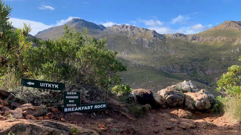
There are numerous safe, well maintained and well marked hiking trails to be enjoyed, ranging from short 1hr walks (Breakfast Rock) to longer day and overnight hikes. The highest peak is Perdekop at 1575m, while Du Toits Kop comes in a close second at 1450m.
Uitkyk is one of the more popular options, as the 7km out and back route can be finished in under 3 hours. There is roughly 360m of elevation gain, where you will venture past some spectacular scenery which includes “Breakfast Rock”, a protea forest, as well as a small stream with fresh, drinkable mountain water. All of this leads up to the highlight of the hike which are the views of the Wemmershoek dam and valley from Uitkyk rock.
If you are feeling energetic, take the DuToitsKop route back. It veers off to the right when leaving Uitkyk, follow the signs as the path zig zags up the side of the mountain. This way back to the main gate is more challenging, and will add another 2 hours to your hike but offers fantastic views. The route is well marked for most of the way, but we did find ourselves having to look for the yellow foot print markers every once in a while. The descent to the car is short but steep, and can take its toll on your toes.
Really difficult to fault this hike other than the lack of decent toilets at the entry gate. If you need supplies make a stop in town before entering the reserve as you can’t buy anything at the gate.
Please note that this is our interpretation of the hike and is not meant to be used for navigation purposes. Hiking can involve dangerous elements, and remember that the weather on top of a mountain is always different to that at the base. Remain aware of your surroundings at all times, wear the appropriate clothing and footwear, don’t litter and stick to the foot paths. Do not light a fire no matter what.
NEED TO KNOW:
- DURATION: 2.5 – 5 hours depending on rest stops.
- DISTANCE: ±7 km
- ELEVATION GAIN: ±400m
- EFFORT LEVEL: 6/10. Moderate.
- REQUIREMENTS: Comfortable shoes, water bottle, snacks, warm top.
- ENTRY FEE: R50 per adult. Children under 16 are free of charge, but need to be accompanied by an adult. Route maps are R20.
- DISTANCE FROM CAPE TOWN: ±85 km
- AMENITIES: Very basic toilets, no restaurant or shop for water etc
- SAFETY: 9/10. Always monitor your surroundings.
- ACCESSIBILTY: Persons with a reasonable fitness level will be able to complete this hike.
- ROUTE MARKINGS: 8/10
Send us a message and together we will design your day of fun and adventure!
FRANSCHHOEK:
MONT ROCHELLE - UITKYK



September 2020
At the top of the Franschhoek pass lies the Mont Rochelle Nature Reserve, which forms part of the Cape Floral Kingdom and is a UNESCO World Heritage site. What makes Mont Rochelle so popular is the magnificent views of the valley’s below, the number of hiking trails, as well as the flora and bird life.
There are numerous safe, well maintained and well marked hiking trails to be enjoyed, ranging from short 1hr walks (Breakfast Rock) to longer day and overnight hikes. The highest peak is Perdekop at 1575m, while Du Toits Kop comes in a close second at 1450m.
Uitkyk is one of the more popular options, as the 7km out and back route can be finished in under 3 hours. There is roughly 360m of elevation gain, where you will venture past some spectacular scenery which includes “Breakfast Rock”, a protea forest, as well as a small stream with fresh, drinkable mountain water. All of this leads up to the highlight of the hike which are the views of the Wemmershoek dam and valley from Uitkyk rock.
If you are feeling energetic, take the DuToitsKop route back. It veers off to the right when leaving Uitkyk, follow the signs as the path zig zags up the side of the mountain. This way back to the main gate is more challenging, and will add another 2 hours to your hike but offers fantastic views. The route is well marked for most of the way, but we did find ourselves having to look for the yellow foot print markers every once in a while. The descent to the car is short but steep, and can take its toll on your toes.
Really difficult to fault this hike other than the lack of decent toilets at the entry gate. If you need supplies make a stop in town before entering the reserve as you can’t buy anything at the gate.
NEED TO KNOW:
- DURATION: 2.5 – 5 hours depending on rest stops.
- DISTANCE: ±7 km
- ELEVATION GAIN: ±400m
- EFFORT LEVEL: 6/10. Moderate.
- REQUIREMENTS: Comfortable shoes, water bottle, snacks, warm top.
- ENTRY FEE: R50 per adult. Children under 16 are free of charge, but need to be accompanied by an adult. Route maps are R20.
- DISTANCE FROM CAPE TOWN: ±85 km
- AMENITIES: Very basic toilets, no restaurant or shop for water etc
- SAFETY: 9/10. Always monitor your surroundings.
- ACCESSIBILTY: Persons with a reasonable fitness level will be able to complete this hike.
- ROUTE MARKINGS: 8/10
*Please note that this is our interpretation of the hike and is not meant to be used for navigation purposes. Hiking can involve dangerous elements, and remember that the weather on top of a mountain is always different to that at the base. Remain aware of your surroundings at all times, wear the appropriate clothing and footwear, don’t litter and stick to the foot paths. Do not light a fire no matter what.
Send us a message and together we will design your day of fun and adventure!
FRANSCHHOEK:
MONT ROCHELLE - UITKYK
September 2020
At the top of the Franschhoek pass lies the Mont Rochelle Nature Reserve, which forms part of the Cape Floral Kingdom and is a UNESCO World Heritage site. What makes Mont Rochelle so popular is the magnificent views of the valley’s below, the number of hiking trails, as well as the flora and bird life.
There are numerous safe, well maintained and well marked hiking trails to be enjoyed, ranging from short 1hr walks (Breakfast Rock) to longer day and overnight hikes. The highest peak is Perdekop at 1575m, while Du Toits Kop comes in a close second at 1450m.
Uitkyk is one of the more popular options, as the 7km out and back route can be finished in under 3 hours. There is roughly 360m of elevation gain, where you will venture past some spectacular scenery which includes “Breakfast Rock”, a protea forest, as well as a small stream with fresh, drinkable mountain water. All of this leads up to the highlight of the hike which are the views of the Wemmershoek dam and valley from Uitkyk rock.
If you are feeling energetic, take the DuToitsKop route back. It veers off to the right when leaving Uitkyk, follow the signs as the path zig zags up the side of the mountain. This way back to the main gate is more challenging, and will add another 2 hours to your hike but offers fantastic views. The route is well marked for most of the way, but we did find ourselves having to look for the yellow foot print markers every once in a while. The descent to the car is short but steep, and can take its toll on your toes.
Really difficult to fault this hike other than the lack of decent toilets at the entry gate. If you need supplies make a stop in town before entering the reserve as you can’t buy anything at the gate.
NEED TO KNOW:
- DURATION: 2.5 – 5 hours depending on rest stops.
- DISTANCE: ±7 km
- ELEVATION GAIN: ±400m
- EFFORT LEVEL: 6/10. Moderate.
- REQUIREMENTS: Comfortable shoes, water bottle, snacks, warm top.
- ENTRY FEE: R50 per adult. Children under 16 are free of charge, but need to be accompanied by an adult. Route maps are R20.
- DISTANCE FROM CAPE TOWN: ±85 km
- AMENITIES: Very basic toilets, no restaurant or shop for water etc
- SAFETY: 9/10. Always monitor your surroundings.
- ACCESSIBILTY: Persons with a reasonable fitness level will be able to complete this hike.
- ROUTE MARKINGS: 8/10
*Please note that this is our interpretation of the hike and is not meant to be used for navigation purposes. Hiking can involve dangerous elements, and remember that the weather on top of a mountain is always different to that at the base. Remain aware of your surroundings at all times, wear the appropriate clothing and footwear, don’t litter and stick to the foot paths. Do not light a fire no matter what.
Send us a message and together we will design your day of fun and adventure!