
JONKERSHOEK: TWEEDE WATERVAL
.
.
June 2020
The Jonkershoek Nature Reserve is situated just outside the town of Stellenbosch, in a valley which is lined by the Stellenbosch mountain range on the one side and the Hottentots-Holland mountains on the other. This is a relatively easy hike, and is family friendly. The reserve is run by Cape Nature and a permit will be required to gain access.
Once you’ve signed in and driven through the gate you will follow a dirt road, which is a circular route and leads you back to the main gate. You will pass a dam on your left, and further on signs for the Swartboskloof hike on your right. Roughly 15-20 minutes after you entered the main gate, and just before the turn around, you will see signs for Tweede Waterval on your right. There is limited parking, but if you continue driving over the small bridge you will find additional parking, about 300m from the start of the hike. Please note the road is not the best, so a vehicle with good ground clearance is advised…your low profile tyres and rims will take a beating here.
The hike is mostly flat, but with a gradual incline as you wind your way up from the 1st to 2nd waterfall. My watch registered a distance of 6.7km out and back. From the car follow the signs to the waterfall. You will walk through the valley, and will be accompanied by the Eerste River on your left, and endless fields of fynbos on your right. Eventually you will come across a split in the path which isn’t marked. If you take the right fork it leads you to Eerste Waterval (1st waterfall), which is about 200-300m from the main path.
If you take the left fork you will continue on to Tweede Waterval (2nd). The route undulates up and down, but with a gradual incline. You will pass sections of the river where you can go down to the waters edge and dip your toes in, or have a small picnic. A little further on you will come to the steep section, between the 2 waterfalls, which will get the heart rate up. Fortunately its only for about 300m and then the path levels out again. There is a wire handrail to assist.
Following that you will arrive at Tweede Waterval, which looks rather unassuming. This is where it gets interesting. To get to the actual waterfall you need to scramble over the boulders in the river bed. Its not as difficult as it looks but you will need to exercise caution. A group of relatively fit yet older ladies where ahead of us, and they managed to navigate their way quite easily. Follow the river for about 300m, and you will come to Tweede Waterval. Its worth the effort!
Please note that this is our interpretation of the hike and is not meant to be used for navigation purposes. Hiking can involve dangerous elements, and remember that the weather on top of a mountain is always different to that at the base. Remain aware of your surroundings at all times, wear the appropriate clothing and footwear, don’t litter and stick to the foot paths. Do not light a fire no matter what.
NEED TO KNOW:
- DURATION: 2 – 4 hours depending on your fitness levels.
- DISTANCE: ±7 km
- EFFORT LEVEL: 5/10
- TECHNICAL DIFFICULTY: 4/10
- REQUIREMENTS: Comfortable shoes, water bottle, snacks, warm top.
- ENTRY FEE: R50 pp.
- DISTANCE FROM CAPE TOWN: ±50 km
- AMENITIES: Toilets at the main gate but nothing inside the park. Restaurants within driving distance.
- SAFETY: 9/10. Always monitor your surroundings.
- ACCESSIBILITY: Persons of any age with reasonable fitness levels will be able to complete the hike.
- ROUTE MARKINGS: 5/10
Send us a message and together we will design your day of fun and adventure!
JONKERSHOEK:
TWEEDE WATERVAL



June 2020
The Jonkershoek Nature Reserve is situated just outside the town of Stellenbosch, in a valley which is lined by the Stellenbosch mountain range on the one side and the Hottentots-Holland mountains on the other. This is a relatively easy hike, and is family friendly. The reserve is run by Cape Nature and a permit will be required to gain access.
Once you’ve signed in and driven through the gate you will follow a dirt road, which is a circular route and leads you back to the main gate. You will pass a dam on your left, and further on signs for the Swartboskloof hike on your right. Roughly 15-20 minutes after you entered the main gate, and just before the turn around, you will see signs for Tweede Waterval on your right. There is limited parking, but if you continue driving over the small bridge you will find additional parking, about 300m from the start of the hike. Please note the road is not the best, so a vehicle with good ground clearance is advised…your low profile tyres and rims will take a beating here.
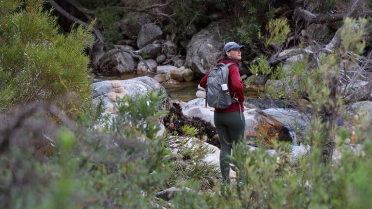
The hike is mostly flat, but with a gradual incline as you wind your way up from the 1st to 2nd waterfall. My watch registered a distance of 6.7km out and back. From the car follow the signs to the waterfall. You will walk through the valley, and will be accompanied by the Eerste River on your left, and endless fields of fynbos on your right. Eventually you will come across a split in the path which isn’t marked. If you take the right fork it leads you to Eerste Waterval (1st waterfall), which is about 200-300m from the main path.
If you take the left fork you will continue on to Tweede Waterval (2nd). The route undulates up and down, but with a gradual incline. You will pass sections of the river where you can go down to the waters edge and dip your toes in, or have a small picnic. A little further on you will come to the steep section, between the 2 waterfalls, which will get the heart rate up. Fortunately its only for about 300m and then the path levels out again. There is a wire handrail to assist.
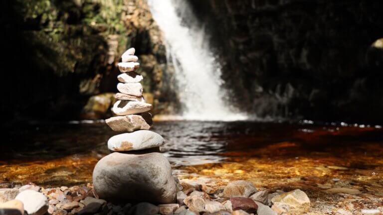
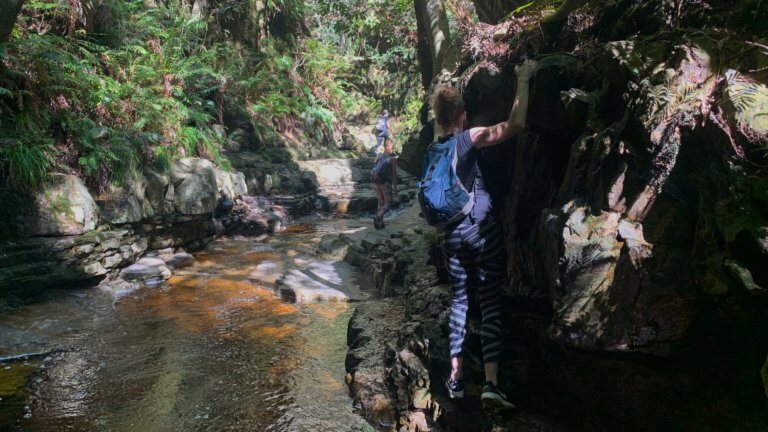
Following that you will arrive at Tweede Waterval, which looks rather unassuming. This is where it gets interesting. To get to the actual waterfall you need to scramble over the boulders in the river bed. Its not as difficult as it looks but you will need to exercise caution. A group of relatively fit yet older ladies where ahead of us, and they managed to navigate their way quite easily. Follow the river for about 300m, and you will come to Tweede Waterval. Its worth the effort!
NEED TO KNOW:
- DURATION: 2 – 4 hours depending on your fitness levels.
- DISTANCE: ±7 km
- EFFORT LEVEL: 5/10
- TECHNICAL DIFFICULTY: 4/10
- REQUIREMENTS: Comfortable shoes, water bottle, snacks, warm top.
- ENTRY FEE: R50 pp.
- DISTANCE FROM CAPE TOWN: ±50 km
- AMENITIES: Toilets at the main gate but nothing inside the park. Restaurants within driving distance.
- SAFETY: 9/10. Always monitor your surroundings.
- ACCESSIBILITY: Persons of any age with reasonable fitness levels will be able to complete the hike.
- ROUTE MARKINGS: 5/10
*Please note that this is our interpretation of the hike and is not meant to be used for navigation purposes. Hiking can involve dangerous elements, and remember that the weather on top of a mountain is always different to that at the base. Remain aware of your surroundings at all times, wear the appropriate clothing and footwear, don’t litter and stick to the foot paths. Do not light a fire no matter what.
Send us a message and together we will design your day of fun and adventure!
JONKERSHOEK:
TWEEDE WATERVAL
June 2020
The Jonkershoek Nature Reserve is situated just outside the town of Stellenbosch, in a valley which is lined by the Stellenbosch mountain range on the one side and the Hottentots-Holland mountains on the other. This is a relatively easy hike, and is family friendly. The reserve is run by Cape Nature and a permit will be required to gain access.
Once you’ve signed in and driven through the gate you will follow a dirt road, which is a circular route and leads you back to the main gate. You will pass a dam on your left, and further on signs for the Swartboskloof hike on your right. Roughly 15-20 minutes after you entered the main gate, and just before the turn around, you will see signs for Tweede Waterval on your right. There is limited parking, but if you continue driving over the small bridge you will find additional parking, about 300m from the start of the hike. Please note the road is not the best, so a vehicle with good ground clearance is advised…your low profile tyres and rims will take a beating here.
The hike is mostly flat, but with a gradual incline as you wind your way up from the 1st to 2nd waterfall. My watch registered a distance of 6.7km out and back. From the car follow the signs to the waterfall. You will walk through the valley, and will be accompanied by the Eerste River on your left, and endless fields of fynbos on your right. Eventually you will come across a split in the path which isn’t marked. If you take the right fork it leads you to Eerste Waterval (1st waterfall), which is about 200-300m from the main path.
If you take the left fork you will continue on to Tweede Waterval (2nd). The route undulates up and down, but with a gradual incline. You will pass sections of the river where you can go down to the waters edge and dip your toes in, or have a small picnic. A little further on you will come to the steep section, between the 2 waterfalls, which will get the heart rate up. Fortunately its only for about 300m and then the path levels out again. There is a wire handrail to assist.
Following that you will arrive at Tweede Waterval, which looks rather unassuming. This is where it gets interesting. To get to the actual waterfall you need to scramble over the boulders in the river bed. Its not as difficult as it looks but you will need to exercise caution. A group of relatively fit yet older ladies where ahead of us, and they managed to navigate their way quite easily. Follow the river for about 300m, and you will come to Tweede Waterval. Its worth the effort!
NEED TO KNOW:
- DURATION: 2 – 4 hours depending on your fitness levels.
- DISTANCE: ±7 km
- EFFORT LEVEL: 5/10
- TECHNICAL DIFFICULTY: 4/10
- REQUIREMENTS: Comfortable shoes, water bottle, snacks, warm top.
- ENTRY FEE: R50 pp.
- DISTANCE FROM CAPE TOWN: ±50 km
- AMENITIES: Toilets at the main gate but nothing inside the park. Restaurants within driving distance.
- SAFETY: 9/10. Always monitor your surroundings.
- ACCESSIBILITY: Persons of any age with reasonable fitness levels will be able to complete the hike.
- ROUTE MARKINGS: 5/10
*Please note that this is our interpretation of the hike and is not meant to be used for navigation purposes. Hiking can involve dangerous elements, and remember that the weather on top of a mountain is always different to that at the base. Remain aware of your surroundings at all times, wear the appropriate clothing and footwear, don’t litter and stick to the foot paths. Do not light a fire no matter what.
Send us a message and together we will design your day of fun and adventure!