
CEDERBERG: MALTESE CROSS
.
.
November 2020
A trip to the Cederberg wouldn’t be complete without paying a visit to the Maltese Cross, near Sanddrif. This hike requires a permit, and an access code for the entry gate. The land belongs to Cape Nature and the permits are available from the reception office at Sanddrif, Dwarsrivier (or at the Algeria campsite). However it is a good idea to book in advance as the trail is limited to 50 persons per day. You can collect the permits and access code from Sanddrif reception, or alternatively it can be left on the notice board for you.
Once you have navigated your way along the dirt roads, past the observatory and through the access gate, you will come across a parking lot, which is a short drive down the dirt road after the gate at the observatory. This is where the hike begins.
A sign points to the start of the trail, which is basically a dirt road or jeep track, which has patches of soft, almost beach like sand along the way. Large shards of sandstone rock lie scattered on either side of you as you advance towards the base of the slope. Soon the trail turns into single track as you begin to make your way up the hill.
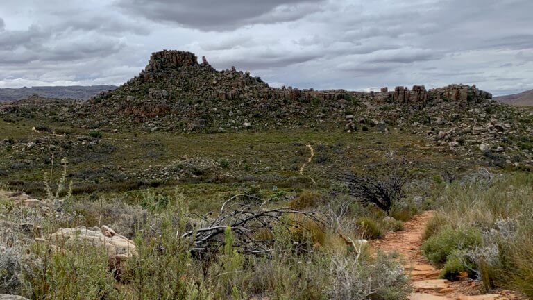
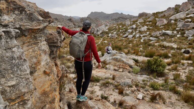
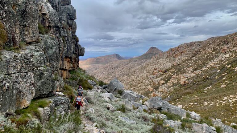
The path is a consistent mix of sand, stones, and loose rock, but it is well defined and easy to follow. Every so often you will come across boulders and rocky terrain where the path is less clear, however there are cairns to help point you in the right direction. When the visibility is good you will have to really try your best to get lost. However in thick mist, you will need to pay close attention to where you are going.
As you ascend it will be worth your while to stop and look back at the views and scenery, plus you will also be able to see where you have come from, with the parking lot and the clearly defined trail below you.
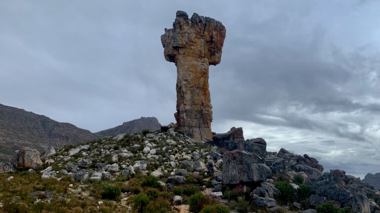
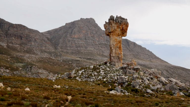
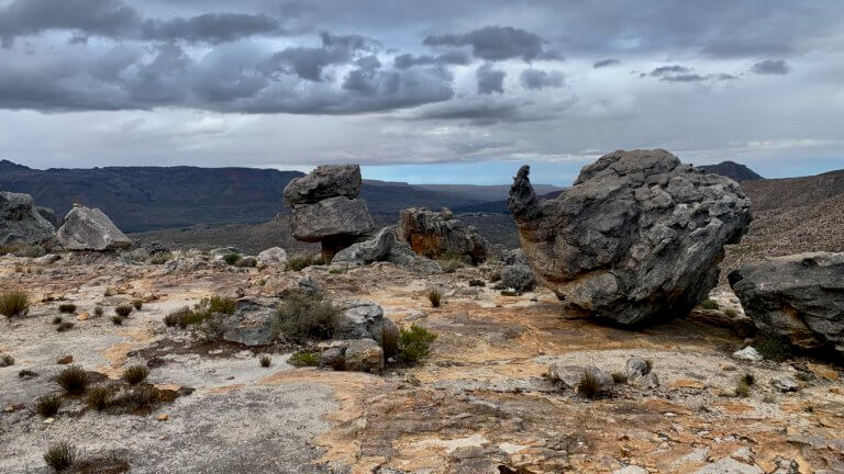
The terrain begins to level out as you approach to the top of the hill, and trail turns into hard compact gravel. The cross soon becomes visible in the distance…and what an extraordinary sight it is. Perched up on a mound in the middle of a wide open, restio filled plain, it protrudes ± 30m into the air like a clenched, orange fist.
Once you are finished exploring, taking pictures and enjoying the views, you can make your way back down the same path. In total my watch clocked a distance of 8km, with an elevation gain of just under 500m. We completed the hike in roughly 3.5 hours, including numerous stops and rest time at the Cross.
Please note that this is our interpretation of the hike and is not meant to be used for navigation purposes. Hiking can involve dangerous elements, and remember that the weather on top of a mountain is always different to that at the base. Remain aware of your surroundings at all times, wear the appropriate clothing and footwear, don’t litter and stick to the foot paths. Do not light a fire no matter what.
NEED TO KNOW:
- DURATION: 3 – 5 hours depending on your fitness levels.
- DISTANCE: ±8 km
- EFFORT LEVEL: 6/10.
- TECHNICAL DIFFICULTY: 5/10
- REQUIREMENTS: Comfortable shoes, water bottle, snacks, warm top.
- ENTRY FEE: R75 from Cape Nature, Sanddrif, or Algeria.
- DISTANCE FROM CAPE TOWN: ±250 km.
- AMENITIES: No toilets available, no water unless you make your way down to the stream which runs along side the trail. This could be a bit trecherous, so use this option in the case of an emergency.
- SAFETY: 10/10.
- ACCESSIBILITY: 8/10. Young kids have been known to complete this hike, but it will be tough going for them and depends on your childs ability. Reasonably fit adults will be able to complete this hike with out much hassle.
- ROUTE MARKINGS: 9/10. No signs, but clear trail and cairns.
Send us a message and together we will design your day of fun and adventure!
CEDERBERG:
MALTESE CROSS


November 2020
A trip to the Cederberg wouldn’t be complete without paying a visit to the Maltese Cross, near Sanddrif. This hike requires a permit, and an access code for the entry gate. The land belongs to Cape Nature and the permits are available from the reception office at Sanddrif, Dwarsrivier (or at the Algeria campsite).
However it is a good idea to book in advance as the trail is limited to 50 persons per day. You can collect the permits and access code from Sanddrif reception, or alternatively it can be left on the notice board for you.
Once you have navigated your way along the dirt roads, past the observatory and through the access gate, you will come across a parking lot, which is a short drive down the dirt road after the gate at the observatory. This is where the hike begins.
A sign points to the start of the trail, which is basically a dirt road or jeep track, which has patches of soft, almost beach like sand along the way. Large shards of sandstone rock lie scattered on either side of you as you advance towards the base of the slope. Soon the trail turns into single track as you begin to make your way up the hill.
The path is a consistent mix of sand, stones, and loose rock, but it is well defined and easy to follow. Every so often you will come across boulders and rocky terrain where the path is less clear, however there are cairns to help point you in the right direction. When the visibility is good you will have to really try your best to get lost. However in thick mist, you will need to pay close attention to where you are going.
As you ascend it will be worth your while to stop and look back at the views and scenery, plus you will also be able to see where you have come from, with the parking lot and the clearly defined trail below you.
The terrain begins to level out as you approach to the top of the hill, and trail turns into hard compact gravel. The cross soon becomes visible in the distance…and what an extraordinary sight it is. Perched up on a mound in the middle of a wide open, restio filled plain, it protrudes ± 30m into the air like a clenched, orange fist.
Once you are finished exploring, taking pictures and enjoying the views, you can make your way back down the same path. In total my watch clocked a distance of 8km, with an elevation gain of just under 500m. We completed the hike in roughly 3.5 hours, including numerous stops and rest time at the Cross.
NEED TO KNOW:
- DURATION: 3 – 5 hours depending on your fitness levels.
- DISTANCE: ±8 km
- EFFORT LEVEL: 6/10.
- TECHNICAL DIFFICULTY: 5/10
- REQUIREMENTS: Comfortable shoes, water bottle, snacks, warm top.
- ENTRY FEE: R75 from Cape Nature, Sanddrif, or Algeria.
- DISTANCE FROM CAPE TOWN: ±250 km.
- AMENITIES: No toilets available, no water unless you make your way down to the stream which runs along side the trail. This could be a bit trecherous, so use this option in the case of an emergency.
- SAFETY: 10/10.
- ACCESSIBILITY: 8/10. Young kids have been known to complete this hike, but it will be tough going for them and depends on your childs ability. Reasonably fit adults will be able to complete this hike with out much hassle.
- ROUTE MARKINGS: 9/10. No signs, but clear trail and cairns.
Please note that this is our interpretation of the hike and is not meant to be used for navigation purposes. Hiking can involve dangerous elements, and remember that the weather on top of a mountain is always different to that at the base. Remain aware of your surroundings at all times, wear the appropriate clothing and footwear, don’t litter and stick to the foot paths. Do not light a fire no matter what.
Send us a message and together we will design your day of fun and adventure!
CEDERBERG:
MALTESE CROSS
November 2020
A trip to the Cederberg wouldn’t be complete without paying a visit to the Maltese Cross, near Sanddrif. This hike requires a permit, and an access code for the entry gate. The land belongs to Cape Nature and the permits are available from the reception office at Sanddrif, Dwarsrivier (or at the Algeria campsite).
However it is a good idea to book in advance as the trail is limited to 50 persons per day. You can collect the permits and access code from Sanddrif reception, or alternatively it can be left on the notice board for you.
Once you have navigated your way along the dirt roads, past the observatory and through the access gate, you will come across a parking lot, which is a short drive down the dirt road after the gate at the observatory. This is where the hike begins.
A sign points to the start of the trail, which is basically a dirt road or jeep track, which has patches of soft, almost beach like sand along the way. Large shards of sandstone rock lie scattered on either side of you as you advance towards the base of the slope. Soon the trail turns into single track as you begin to make your way up the hill.
The path is a consistent mix of sand, stones, and loose rock, but it is well defined and easy to follow. Every so often you will come across boulders and rocky terrain where the path is less clear, however there are cairns to help point you in the right direction. When the visibility is good you will have to really try your best to get lost. However in thick mist, you will need to pay close attention to where you are going.
As you ascend it will be worth your while to stop and look back at the views and scenery, plus you will also be able to see where you have come from, with the parking lot and the clearly defined trail below you.
The terrain begins to level out as you approach to the top of the hill, and trail turns into hard compact gravel. The cross soon becomes visible in the distance…and what an extraordinary sight it is. Perched up on a mound in the middle of a wide open, restio filled plain, it protrudes ± 30m into the air like a clenched, orange fist.
Once you are finished exploring, taking pictures and enjoying the views, you can make your way back down the same path. In total my watch clocked a distance of 8km, with an elevation gain of just under 500m. We completed the hike in roughly 3.5 hours, including numerous stops and rest time at the Cross.
NEED TO KNOW:
- DURATION: 3 – 5 hours depending on your fitness levels.
- DISTANCE: ±8 km
- EFFORT LEVEL: 6/10.
- TECHNICAL DIFFICULTY: 5/10
- REQUIREMENTS: Comfortable shoes, water bottle, snacks, warm top.
- ENTRY FEE: R75 from Cape Nature, Sanddrif, or Algeria.
- DISTANCE FROM CAPE TOWN: ±250 km.
- AMENITIES: No toilets available, no water unless you make your way down to the stream which runs along side the trail. This could be a bit trecherous, so use this option in the case of an emergency.
- SAFETY: 10/10.
- ACCESSIBILITY: 8/10. Young kids have been known to complete this hike, but it will be tough going for them and depends on your childs ability. Reasonably fit adults will be able to complete this hike with out much hassle.
- ROUTE MARKINGS: 9/10. No signs, but clear trail and cairns.
Please note that this is our interpretation of the hike and is not meant to be used for navigation purposes. Hiking can involve dangerous elements, and remember that the weather on top of a mountain is always different to that at the base. Remain aware of your surroundings at all times, wear the appropriate clothing and footwear, don’t litter and stick to the foot paths. Do not light a fire no matter what.
Send us a message and together we will design your day of fun and adventure!