
HELDERBERG: WEST PEAK
.
.
May 2022
Closed until further notice due to fire damage – June 12 2022
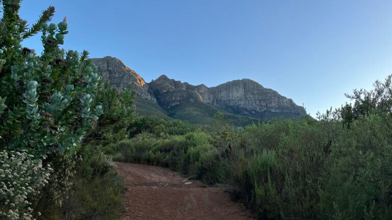
The iconic Helderberg Mountain, which makes up part of the Somerset West skyline, is dominated by 2 peaks. The Dome and West Peak. West Peak is the easier of the 2, but it is still a fairly tough hike, you will need to be fit, and be prepared to spend several hours hiking. There are some really steep uphill sections along dirt roads, as well as up single track paths, but they are not technical in nature. This is an enjoyable hike, but take it slow and be well prepared.
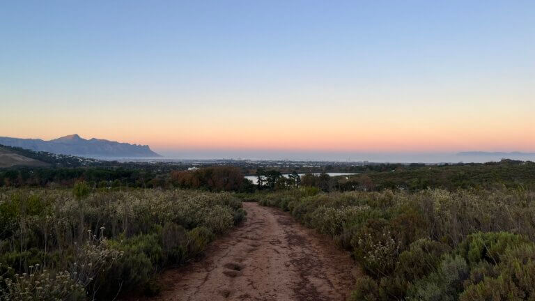
Park at the entrance to the nature reserve, or drive into the newly renovated cafe area. Make sure you dont walk straight ahead and into the “sugarbird trail” as you will end up wasting time and energy doing a loop that brings you back to the start. Instead, with the mountain in front of you, turn right and head up the grass embankment and get onto the dirt road which takes you in the direction of the mountain.
The route you want to follow is the Protea Trail, which is a big loop up the base of the mountain. It gets you to just under half way, before turning back down. This trail follows a dirt road, with numerous switchbacks, is steep in places and can be slippery in winter. Follow the trail until you get to the top, where you will find a bench to take a breather. From here follow the signs pointing you towards the West peak and Dome routes.
The trail now turns into single track, and you will soon make your way into a gorge and up to a bridge. Again follow the signs and walk over the bridge. The trail continues to wind its way up the mountain, with numerous switch backs. The trail is steep but there are numerous places to take a rest. You will eventually come to a relatively flat and open part of the trail, you are now almost 2/3’s of the way.
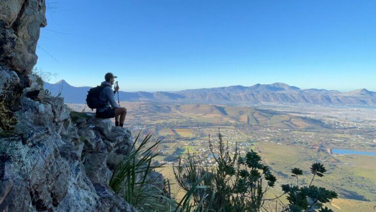
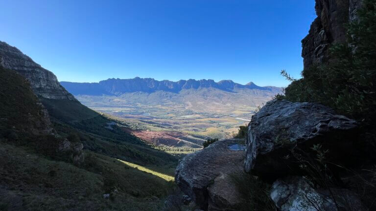
The trail comes to a minor split, take the fork to the left and up. You can go to the right, but it does get a little exposed at one point as you walk along the edge of the cliff. Continue along the trail until you get up to the saddle. Again this section of the trail is steep, and there are sections where you will need to use your hands to get down a boulder or 2. Nothing too serious though.
Once at the saddle follow the sign pointing to West Peak. You will soon come across a section of large boulders, where the trail becomes less clear. Look for worn and dirty rock, which is an indication that people have stepped there. Its hard to get lost here despite the lack of cairns, just make your way in the direction of the top and you will be fine. Soon enough you will see the summit, indicated by a trig beacon.
When its time to leave follow the same route back down, and be wary of the steep sections. It’s ok if you need to shuffle down on your bum, we’ve seen plenty people do it. Rather be safe than sorry. Also remember that the dirt road coming down can be slippery, so shoes with adequate grip are preferable. Once back at the car, head to the new cafe or to Lourensford for a coffee or well earned breakfast!
Please note that this is our interpretation of the hike and is not meant to be used for navigation purposes. Hiking can involve dangerous elements, and remember that the weather on top of a mountain is always different to that at the base. Remain aware of your surroundings at all times, wear the appropriate clothing and footwear, don’t litter and stick to the foot paths. Do not light a fire no matter what.
NEED TO KNOW:
- DURATION: 4 – 7 hours depending on your fitness levels.
- DISTANCE: ±13 km
- ELEVATION GAIN: ±875M
- EFFORT LEVEL: 9/10
- TECHNICAL DIFFICULTY: 5/10
- REQUIREMENTS: Comfortable shoes, water bottle, snacks, warm top.
- ENTRY FEE: R25 pp, R15 per vehicle.
- AMENITIES: Toilets at the entrance
- SAFETY: 8/10 Always monitor your surroundings.
- ACCESSIBILITY: You will need to be fit and mobile to complete this hike.
- SCENERY: 8/10
Send us a message and together we will design your day of fun and adventure!
HELDERBERG
WEST PEAK


May 2022
Closed until further notice due to fire damage – June 12 2022
The iconic Helderberg Mountain, which makes up part of the Somerset West skyline, is dominated by 2 peaks. The Dome and West Peak. West Peak is the easier of the 2, but it is still a fairly tough hike, you will need to be fit, and be prepared to spend several hours hiking. There are some really steep uphill sections along dirt roads, as well as up single track paths, but they are not technical in nature. This is an enjoyable hike, but take it slow and be well prepared.
Park at the entrance to the nature reserve, or drive into the newly renovated cafe area. Make sure you dont walk straight ahead and into the “sugarbird trail” as you will end up wasting time and energy doing a loop that brings you back to the start. Instead, with the mountain in front of you, turn right and head up the grass embankment and get onto the dirt road which takes you in the direction of the mountain.
The route you want to follow is the Protea Trail, which is a big loop up the base of the mountain. It gets you to just under half way, before turning back down. This trail follows a dirt road, with numerous switchbacks, is steep in places and can be slippery in winter. Follow the trail until you get to the top, where you will find a bench to take a breather. From here follow the signs pointing you towards the West peak and Dome routes.
The trail now turns into single track, and you will soon make your way into a gorge and up to a bridge. Again follow the signs and walk over the bridge. The trail continues to wind its way up the mountain, with numerous switch backs. The trail is steep but there are numerous places to take a rest. You will eventually come to a relatively flat and open part of the trail, you are now almost 2/3’s of the way.
The trail comes to a minor split, take the fork to the left and up. You can go to the right, but it does get a little exposed at one point as you walk along the edge of the cliff. Continue along the trail until you get up to the saddle. Again this section of the trail is steep, and there are sections where you will need to use your hands to get down a boulder or 2. Nothing too serious though.
Once at the saddle follow the sign pointing to West Peak. You will soon come across a section of large boulders, where the trail becomes less clear. Look for worn and dirty rock, which is an indication that people have stepped there. Its hard to get lost here despite the lack of cairns, just make your way in the direction of the top and you will be fine. Soon enough you will see the summit, indicated by a trig beacon.
When its time to leave follow the same route back down, and be wary of the steep sections. It’s ok if you need to shuffle down on your bum, we’ve seen plenty people do it. Rather be safe than sorry. Also remember that the dirt road coming down can be slippery, so shoes with adequate grip are preferable. Once back at the car, head to the new cafe or to Lourensford for a coffee or well earned breakfast!
NEED TO KNOW:
- DURATION: 4 – 7 hours depending on your fitness levels.
- DISTANCE: ±13 km
- ELEVATION GAIN: ±875M
- EFFORT LEVEL: 9/10
- TECHNICAL DIFFICULTY: 5/10
- REQUIREMENTS: Comfortable shoes, water bottle, snacks, warm top.
- ENTRY FEE: R25 pp, R15 per vehicle.
- AMENITIES: Toilets at the entrance
- SAFETY: 8/10 Always monitor your surroundings.
- ACCESSIBILITY: You will need to be fit and mobile to complete this hike.
- SCENERY: 8/10
Please note that this is our interpretation of the hike and is not meant to be used for navigation purposes. Hiking can involve dangerous elements, and remember that the weather on top of a mountain is always different to that at the base. Remain aware of your surroundings at all times, wear the appropriate clothing and footwear, don’t litter and stick to the foot paths. Do not light a fire no matter what.
Send us a message and together we will design your day of fun and adventure!
HELDERBERG
WEST PEAK
May 2022
Closed until further notice due to fire damage – June 12 2022
The iconic Helderberg Mountain, which makes up part of the Somerset West skyline, is dominated by 2 peaks. The Dome and West Peak. West Peak is the easier of the 2, but it is still a fairly tough hike, you will need to be fit, and be prepared to spend several hours hiking. There are some really steep uphill sections along dirt roads, as well as up single track paths, but they are not technical in nature. This is an enjoyable hike, but take it slow and be well prepared.
Park at the entrance to the nature reserve, or drive into the newly renovated cafe area. Make sure you dont walk straight ahead and into the “sugarbird trail” as you will end up wasting time and energy doing a loop that brings you back to the start. Instead, with the mountain in front of you, turn right and head up the grass embankment and get onto the dirt road which takes you in the direction of the mountain.
The route you want to follow is the Protea Trail, which is a big loop up the base of the mountain. It gets you to just under half way, before turning back down. This trail follows a dirt road, with numerous switchbacks, is steep in places and can be slippery in winter. Follow the trail until you get to the top, where you will find a bench to take a breather. From here follow the signs pointing you towards the West peak and Dome routes.
The trail now turns into single track, and you will soon make your way into a gorge and up to a bridge. Again follow the signs and walk over the bridge. The trail continues to wind its way up the mountain, with numerous switch backs. The trail is steep but there are numerous places to take a rest. You will eventually come to a relatively flat and open part of the trail, you are now almost 2/3’s of the way.
The trail comes to a minor split, take the fork to the left and up. You can go to the right, but it does get a little exposed at one point as you walk along the edge of the cliff. Continue along the trail until you get up to the saddle. Again this section of the trail is steep, and there are sections where you will need to use your hands to get down a boulder or 2. Nothing too serious though.
Once at the saddle follow the sign pointing to West Peak. You will soon come across a section of large boulders, where the trail becomes less clear. Look for worn and dirty rock, which is an indication that people have stepped there. Its hard to get lost here despite the lack of cairns, just make your way in the direction of the top and you will be fine. Soon enough you will see the summit, indicated by a trig beacon.
When its time to leave follow the same route back down, and be wary of the steep sections. It’s ok if you need to shuffle down on your bum, we’ve seen plenty people do it. Rather be safe than sorry. Also remember that the dirt road coming down can be slippery, so shoes with adequate grip are preferable. Once back at the car, head to the new cafe or to Lourensford for a coffee or well earned breakfast!
NEED TO KNOW:
- DURATION: 4 – 7 hours depending on your fitness levels.
- DISTANCE: ±13 km
- ELEVATION GAIN: ±875M
- EFFORT LEVEL: 9/10
- TECHNICAL DIFFICULTY: 5/10
- REQUIREMENTS: Comfortable shoes, water bottle, snacks, warm top.
- ENTRY FEE: R25 pp, R15 per vehicle.
- AMENITIES: Toilets at the entrance
- SAFETY: 8/10 Always monitor your surroundings.
- ACCESSIBILITY: You will need to be fit and mobile to complete this hike.
- SCENERY: 8/10
Please note that this is our interpretation of the hike and is not meant to be used for navigation purposes. Hiking can involve dangerous elements, and remember that the weather on top of a mountain is always different to that at the base. Remain aware of your surroundings at all times, wear the appropriate clothing and footwear, don’t litter and stick to the foot paths. Do not light a fire no matter what.
Send us a message and together we will design your day of fun and adventure!